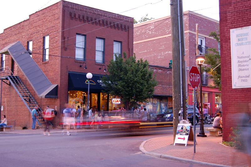

Four facts set up everything below. Charlotte had about 18,000 people in 1900 and 83,000 by 1930. The Piedmont around it became, in the nomination's words, "the world's leading textile manufacturing region". By 1930 Charlotte was the largest city in either Carolina. And the thing that made the suburbs possible was the electric streetcar.
Dilworth — the first one
Charlotte's first streetcar suburb: about 63 blocks on 395 acres, on what was then the south-eastern fringe and is now well inside the city.
It was the work of one man, Edward Dilworth Latta, who brought the first electric trolley system to Charlotte and then planned a suburb around it — the line first, the neighbourhood after. The original grid was platted by Joseph Forsyth Johnson of New York and featured a grand boulevard, three sections of which were built and survive, and a park at the eastern end with a pool, lakes, a pavilion, a theatre and ball fields.
Then in 1911 Latta did something more ambitious. He bought more land and hired the Olmsted Brothers — the firm of the man who designed Central Park. Their plan for a 300-acre hourglass-shaped tract ran a grand avenue north that split at the "waist" into east and west drives, so a trolley could loop through, with smaller curving streets branching off.
The southern section was built to the Olmsted plan. The northern section was not — but it took the curving streets anyway.
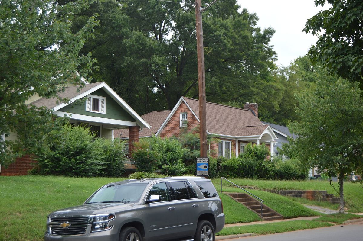

Myers Park — the one everybody copied
Begun the same year, 1911, and described in its nomination as "the premier streetcar suburb of Charlotte". 958 structures in the district.
The significance is not the houses, though C. C. Hook, Louis Asbury and J. M. McMichael all built here and Philadelphia's Charles Barton Keen came down for it. The significance is the planning.
John Nolen of Boston designed it — "one of America's most important early-twentieth century planning pioneers", in the nomination's words. His plan had "an unusual degree of detail, ranging from parks and curving streets to the design of individual house lot landscaping". He put it in front of the country in his 1927 book New Towns for Old.
It worked. The Manufacturers Record of 3 November 1921 called Myers Park the "finest unified suburban development south of Baltimore". And a young planner who trained on the job, Earle Sumner Draper, went on to plan hundreds of Myers Park-inspired developments across the South.
If you want one sentence for why Charlotte is the shape it is, the nomination supplies it: Myers Park made the south-east desirable, and "today the city's boundaries show a pronounced southeasterly bulge". The city grew toward its money.
Who lived here: J. B. Duke, Cameron Morrison, George Stephens, and the banking, textile, utility and real-estate leadership of the whole Piedmont — not just Charlotte.
Elizabeth — the one with the mixed housing
Period of significance 1900 to 1941. Architects included F. L. Bonfoey, Louis Asbury and J. M. McMichael.
Two things make Elizabeth distinct. It holds Independence Park, Charlotte's first public park, whose original design was an early commission of John Nolen — before Myers Park made his name here.
And where the other early suburbs are houses, Elizabeth has "a particularly large and noteworthy assemblage of 1920s and 1930s duplexes and small apartment buildings". It was built for a wider range of people from the start, and it still reads that way on the street.

North Charlotte — the mill district that became NoDa
A different Charlotte entirely. "A particularly well-preserved early 20th-century textile mill district" of roughly 438 resources: the mills, the villages built for the people who worked them, some middle-class houses and a small business district.
Three factories: the 1903 Highland Park Mill No. 3, the 1905 Mecklenburg Mill and the 1913 Johnston Mill. Two substantially intact mill villages — built by the owners to house their workforce in self-contained communities.
The dates tell the story. Almost everything went up between 1903 and about 1915. Then the Great Depression drastically curtailed development in the mid-1930s, and the neighbourhood stopped.
What is now an arts district was a company town, and the street pattern is still the company's.
Wesley Heights — built for the car, almost
Plans for the Wadsworth family farmland were made as early as 1911, and the neighbourhood started that year with the Wadsworth house at 400 S. Summit Avenue. Most of it went up in the 1920s, after what the nomination calls an aggressive marketing campaign.
Two details worth knowing. There was no planning system, so the developers used restrictive deed covenants to control how it would look — each lot sold separately, but the covenants held the whole together.
And although two streetcar lines served it, the nomination records that residents "were as dependent on the automobile for transportation as on the electric trolley". Wesley Heights sits on the hinge between the streetcar city and the car one.
Like Elizabeth, it was not built only for families: there are a lot of duplexes and quadruplexes, put up for single people and new arrivals in a city whose population was more than quadrupling.
A note on these documents
Every fact on this page comes from a National Register nomination. They are public, they are free, and anyone can read them at the North Carolina State Historic Preservation Office.
They are also of their time. Dilworth's and Myers Park's nominations were written in 1987, North Charlotte's in 1990. They reflect what their authors chose to examine then, and later scholarship can supersede them — particularly on questions of who was excluded from these neighbourhoods and how. Where we know more, we say so and cite it separately. Where we do not, we have not filled the gap with a guess.
Sources
- Myers Park Historic District, National Register nomination MK0090, listed 10 August 1987
- Dilworth Historic District, MK0127, listed 9 April 1987
- Elizabeth Historic District, MK0866, listed 3 January 1989
- North Charlotte Historic District, MK1666, listed 16 March 1990
- Wesley Heights Historic District, MK1793, listed 29 November 1995
All retrieved from the N.C. State Historic Preservation Office, 17 September 2026.
Places on this page, in detail
- Transportation · public art
- Transportation · public art
- Dilworth Historic District · Late 19Th And 20Th Century Revivals
- Elizabeth Historic District · Colonial Revival
- Myers Park Historic District · Colonial Revival
- North Charlotte Historic District · Bungalow/Craftsman
- Wesley Heights Historic District · Bungalow/Craftsman
- Independence Park · Park
- Wadsworth House · Bungalow
Read next
Local landmark or National Register? What the labels actually mean
If you have looked into an old Charlotte building you will have met both phrases, often on the same…
Who designed Charlotte: the planned suburbs
Drive through Dilworth, Myers Park or Elizabeth and the streets curve where a developer working to a…
Dilworth
Dilworth was laid out for Edward Dilworth Latta, and it kept his middle name. The National Register of…
NoDa (North Charlotte)
NoDa is short for North Davidson, the street it grew up along. The name is recent; the place is not. On…
The Historic West End
West of Uptown, around the campus of Johnson C. Smith University, is a network of neighbourhoods that…
University City
Charlotte's north-eastern quarter is organised around a university, a boulevard and a rail line, and…